Things to know about drone geotag survey: Explained
Geotagging is one of the latest additions that help to add metadata containing geographical information. The data or information mainly consists of longitude & latitude coordinates, street addresses, postal zip codes, towns, timestamps, additional info, etc. Apart from that, altitude data can also be included in the geographical information. The geotagging metadata can easily be added programmatically or manually. Geotagging is a useful method of drome surveying. It allows you to geotag your images precisely. In this blog, we are going to discuss how to set up a drone geotag survey.

1. Check the regulations
Before you start surveying the drone, you need to check the local regulations & make sure that you will be allowed to use the drone for surveying applications. You also make sure that the weather condition is good. This means there is no risk of rain, fog, storms, snowfalls, heavy winds, etc. Apart from that, you need to check the drone batteries & all the ports and connections. You must make sure that your drone has enough storage space to store images and videos.
2. Make a survey plan
After checking all the regulations, you need to make a proper survey flight plan with a planning app on your smart devices such as tablets, drones, smartphones, etc. For this, all you need to do is just drag all the points around the survey area. If required, you may adjust different settings modes like ground sampling distance (GSD), altitude, images overlap, and flight direction.
3. Configure the drone in the field
This is one of the crucial steps that you need to follow properly. You have to safely unpack & assemble your drone & configure it properly before flying. Make sure that the drone is completely ready to fly in a safe condition. You can make a pre-flying checklist and check all the parameters before taking off. Make sure that the camera lid is properly removed.
4. Capture images
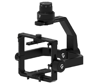
The drone starts taking off autonomously after pressing the take-off switch. Commercial drones can easily capture high-quality images & store them in memory. High-quality drones are equipped with advanced features and they can be easily fitted with advanced commercial gimbals or camera stabilizers. These gimbals can support multiple cameras that will give you a seamless image-capturing experience and take your surveying applications to another level.

5. Geotag the images
Finally, after one or multiple flights, import the high-quality images into a software application to properly geotag them. Drone geotagging application accurately assigns geographical position & information or data to the high-quality images either in the meta-data or in a separate file.
Wrapping up
Surveying with a highly advanced commercial drone gives huge potential to professionals. With a drone & gimbal, it’s easier to carry out all kinds of topographic surveys and highly precise measurements. Drone surveying reduces the overall site survey cost substantially & the workload of professionals in the survey field.
If you are looking for the best commercial gimbals online for industrial surveying and drone geotag applications, look no further than Air Supply. They offer a comprehensive range of high-quality branded drone gimbals and accessories at the lowest price. All products are suitable for accurate geo-mapping, industrial surveying, geoengineering, and GIS applications. Moreover, all products are compact and specially designed to meet industry standards. What are you waiting for? Explore their range of products and order yours today.


Comments
Post a Comment